Heritage of the Ashgrove Area
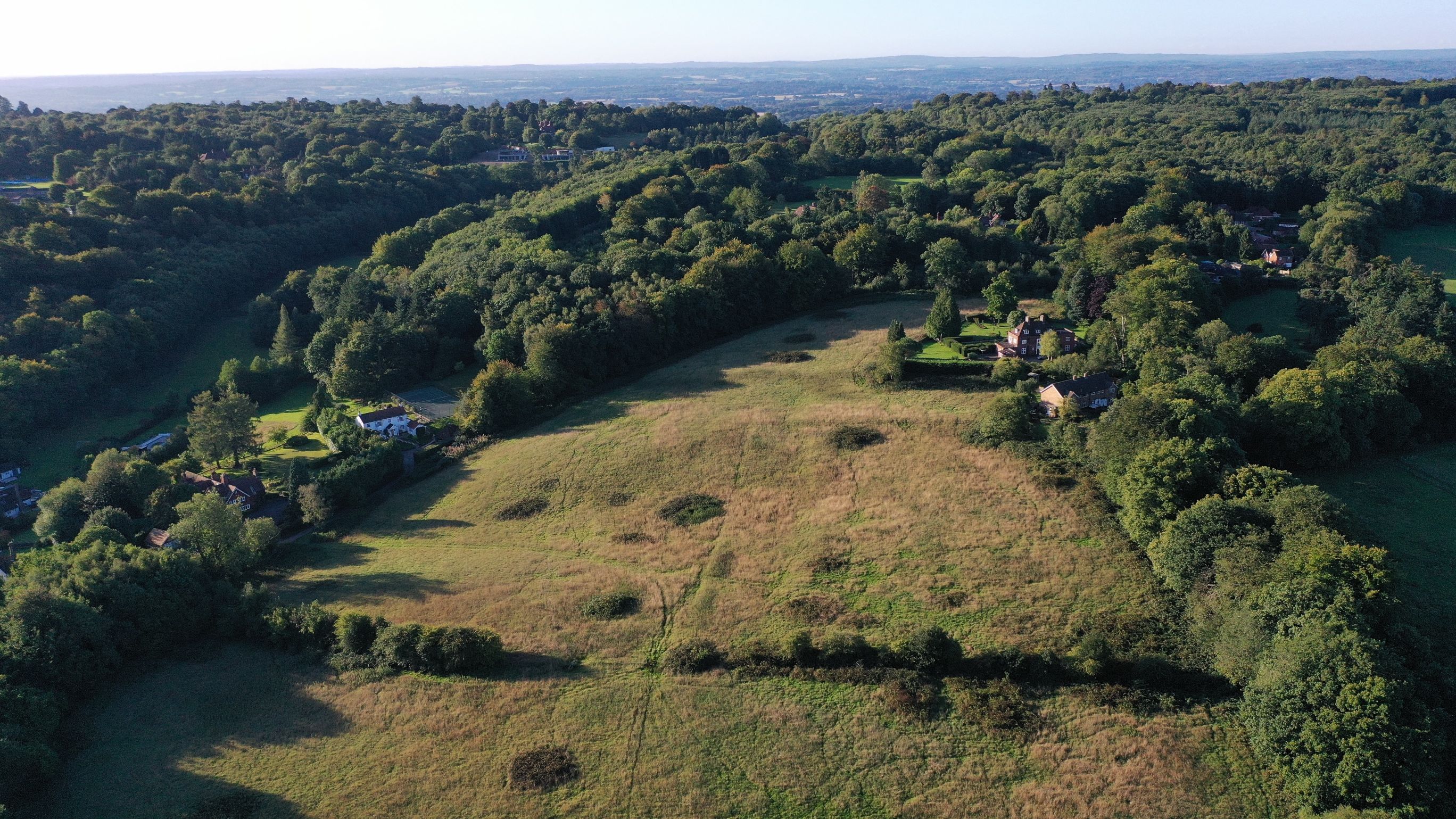
Drone shots taken by Mick of Hillwood, Oak Lane - Contact email
Privileged
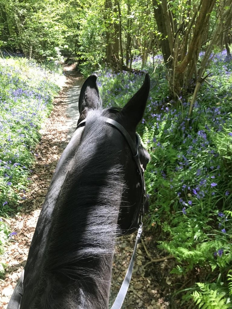
We are privileged to be surrounded by an area of outstanding natural beauty. It's rich in biodiversity, heritage and nature. Its footpaths, farm tracks and ancient woodlands go back centuries.
It's enjoyed by our community, cyclists, dog walkers, horse riders, ramblers and other visitors to the area .
Archaeological Features
Indeed, there are many linear archaeological features in our landscape that seem to reflect even prehistoric activity and more recent historic use, including from circa 1760 to what is now West Heath School, together with Ashgrove and Fig Street farms.
The area also incorporates key components of the archaeological and historic landscape, including Charlie’s Lane and connecting woodland footpaths which we must preserve.
Modern History
A 1797 map of the Hundred of Codsheath (incorporating what was then described as Sevenoke) even then shows our area as a mixture of agricultural fields and woodland extending into the Weald, linked to Sevenoaks Common and beyond to Knole Park.
South of Ashgrove Road, the heritage and magnificent landscape created by the AONB has not really altered.
Evolution of the Landscape
It looks as if modern evolution of the landscape is associated with what is now West Heath School. It started life as Ashgrove House in circa 1760, when it was built by Captain John Smyth, a friend of Lord George Sackville.
In the 1800's, it was bought by Kirkman Hodgson an MP who bought more land, including Cross Keys and the Dransfield farms. It was then bought by Edward Kraftmier in 1907. It then seems one Howson Foulger Devitt acquired it - possibly around the lead up to or during the First World War - and in July 1924 (possibly to settle tax duties post war or because of the cost of running it) started selling parcels of the land around what is now West Health School, including possibly the building that is now the School and moved to Longspring off Oak Lane.
Notability, even then the sale documents included restrictive covenants relating to development on the estate and farm lands.
West Heath School
What is now the School was bought by a Mrs Elliot in circa 1932 when it became a school, attended by possibly its most famous pupil, Diana Princess of Wales, RIP.
It is now owned by the ‘Al Fayed Charitable Trust‘ in Diana’s memory and dedicated to serving children in our area and beyond with social, emotional and mental heath needs.
Boundaries
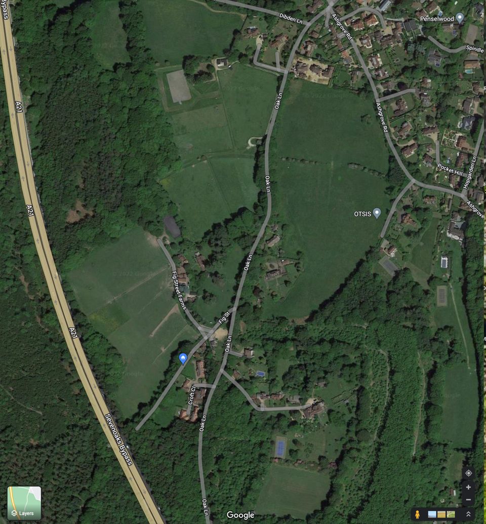
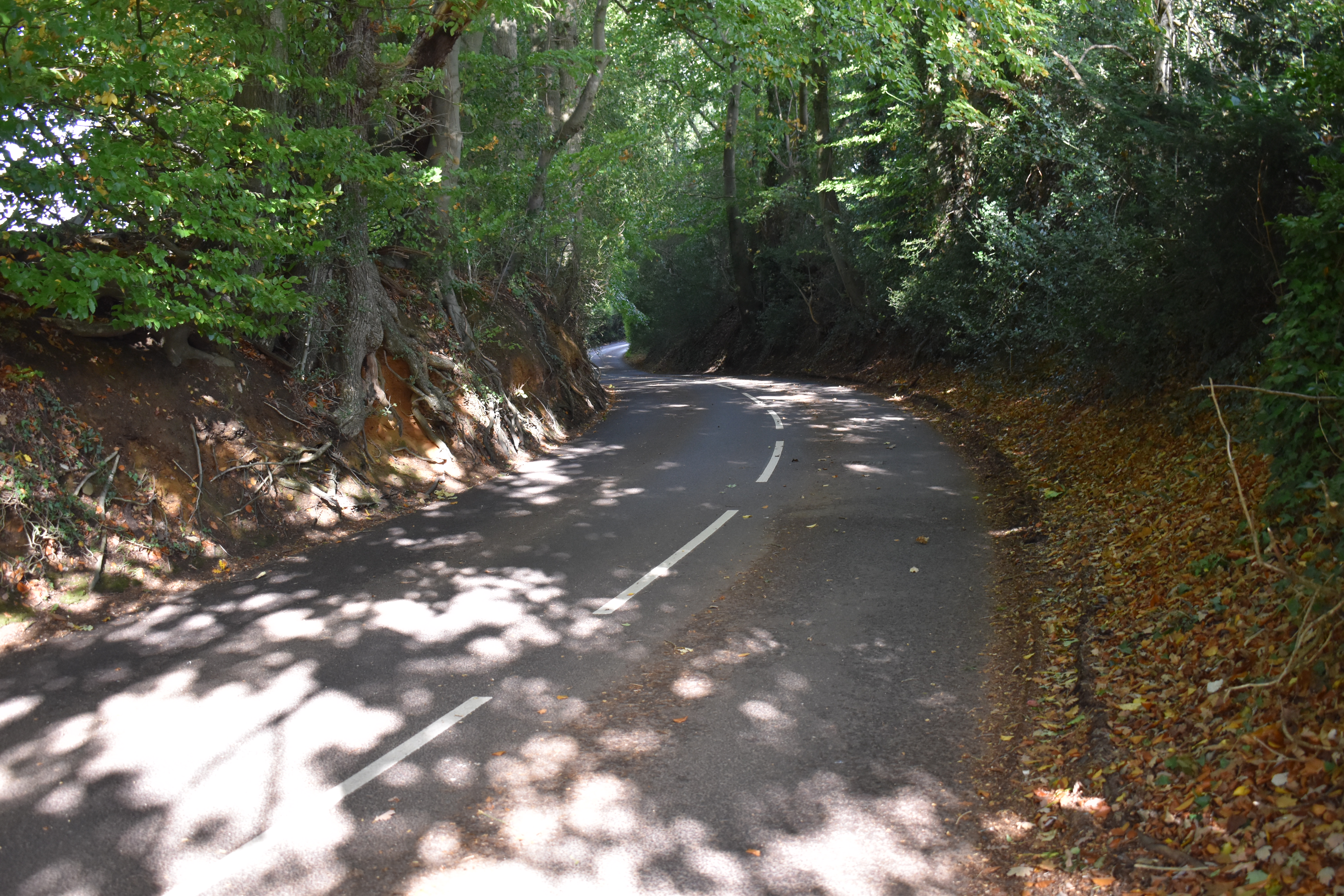
In drawing up the boundaries of the urban area of Sevenoaks the planners were very cognisant of the distinction between the urban area, essentially the North side of Ashgrove Road and the beginning of the countryside, demarked by Ashgrove Road given that it is very narrow, in the most part, with very limited sight lines and a lack of pavements, as is Oak Lane, which is essentially AONB on both sides of the Lane south of Ashgrove Road, leading up to Gracious Lane, Sevenoaks Common and beyond.
Over 50 years
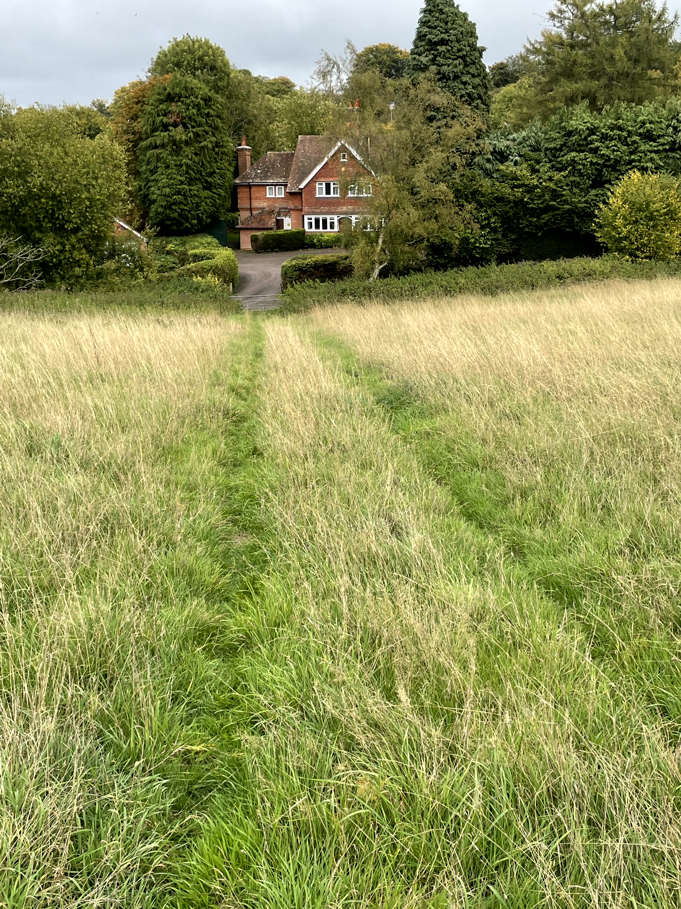
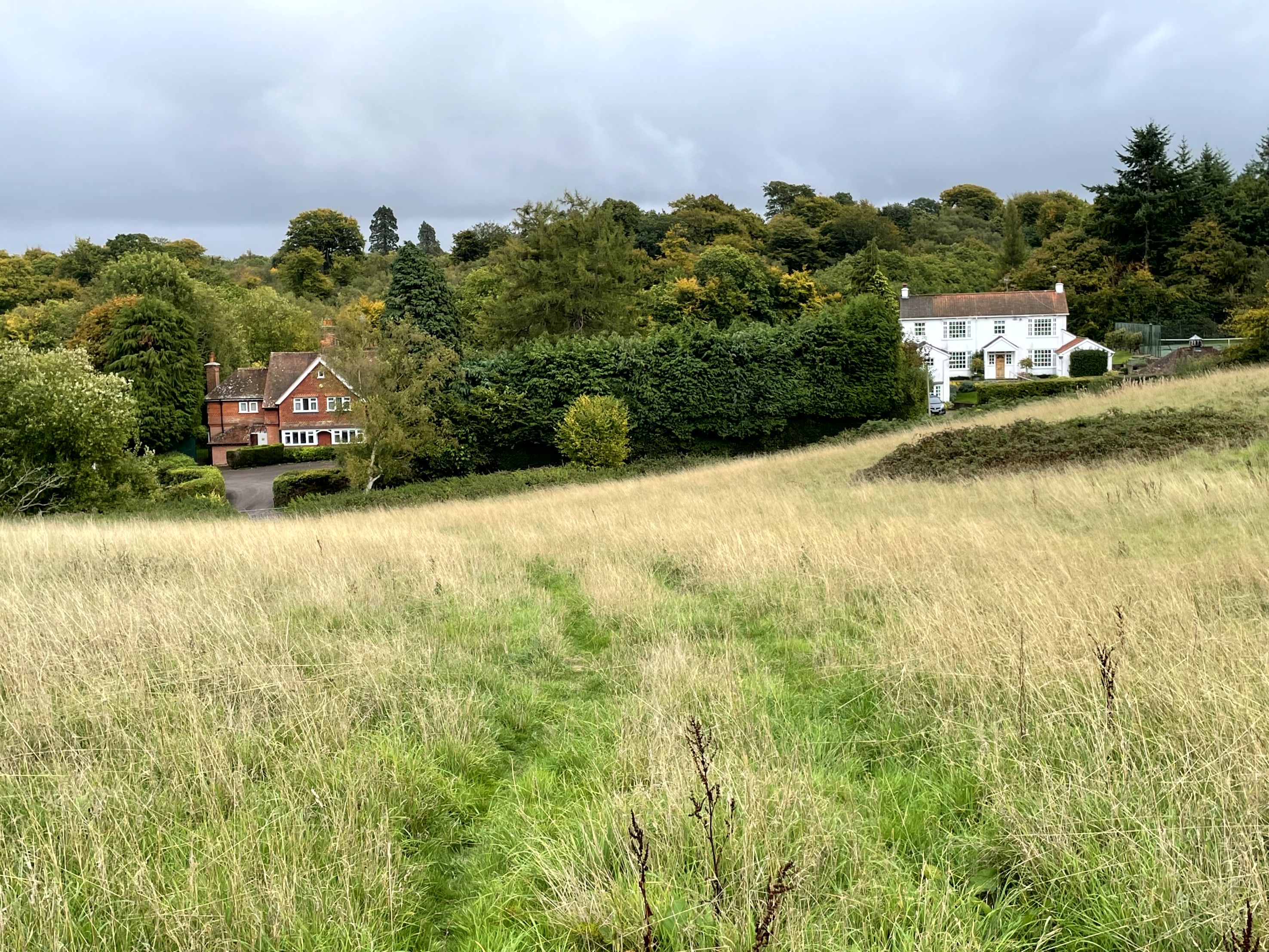
There has essentially been no major new build and very limited brownfield development South of Ashgrove Road for over 50 years. The three or so homes, on historic “Silly Charlies Lane” (now a registered byway with no general access for vehicles and motorbikes ), including the former Laundry of West Heath School, are very long established, as is nearby Cross Keys Cottage and Ashgrove Farm.
Fig Street House was built in about 1926. The very small Longspring development is the former estate owned by Mr Devitt, who moved from what was then Ashgrove House (now West Heath School ) in the 1920s. The main house was then divided in two and the wood keeper’s cottage, chauffeur’s garage and accommodation, along with the gate keeper’s home, converted into houses with the later breakup of the estate, circa 1950s.
Silly Charlie's Lane
Silly Charlie’s Lane is believed to be one of the oldest route-ways in the area; predating the modern town of Sevenoaks by hundreds of years.
It is understood to have been used by fishermen from Rye in Anglo-Saxon times and later onto Chipstead (market place) at the navigable head of the River Darent. Hence the importance of its preservation and the landscape surrounding it.
The Croft
The small development on Oak Lane, opposite Longspring - the Croft - was originally an Isolation Hospital and then served as a ‘short stay’ home for children with special needs.
Fig Street is essentially the farming complex going back 100s of years and the four flats making up the small block below Fig Street House the original Isolation Hospital, before being converted into a small nurses' home and then flats, circa 1950s.
Oak Warren
The only recent new build is just before Gracious Lane at Oak Warren (plus some infill on former stables on Gracious Lane). This came about by necessity to remove a ‘scar on the landscape’.
In essence, a person began clearing the land and putting in foundations to build a motel in flagrant breach of planning and building regulations in the early 1990s. The Council rightly stopped this as soon as it could.
After a great deal of debate about what to do, the conclusion, as a ‘one off’, was to allow the construction of circa 20 modest bungalows, initially envisaged as retirement homes.
Hyde Cottage
Finally, what was Hyde Cottage upon which three luxury new homes have recently been built was infill, with parts of the gardens being sold by the owners of the adjoining field in a separate sale.
There has been no encroachment of build onto the Green Belt or AONB.


